
    |
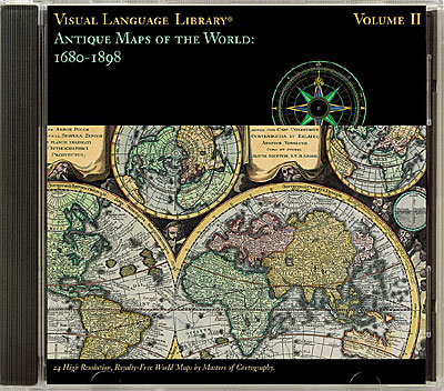
Discover 24 stunningly designed and beautifully detailed antique maps embellished with scientific diagrams and mythological art. All images have been drum scanned and expertly enhanced and are provided in three (high, med, and lo) resolutions each. High resolution images are 30MB RGB TIFF (or 10MB greyscale). Historical information about the maps is provided in a special read-me file.
|
 |
|
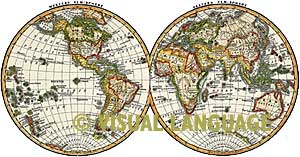
0l Sanson, c.1680-1700
02 Carel A11ard, 1696
03 Vincenzo M. Coronelli, 1697
04 John Harris, c.1697
05 Adam F. Zürner, c. 1700
06 Heinrich Scherer c. 1702-1710
07 Eberhard Happel, 1687-1708
08 Andreas Cellarius, 1708
09 Jean Baptiste Nolin, 1708
10 Pieter van der Aa, c. 1713
11 William Delisle, 1720
12 Pieter van der Aa, 1729
|
13 Johann Baptist Homann, 1729
14 Matthias Seutter, 1730
15 R. & G. Wetstein, 1735
16 Thomas Bowen, c. 1785
l7 Carington Bowles, c. 1790
18 Benjamin Martin, 1794
19 Laurie & Whittle, 1800
20 G. Aikman, c. 1850
21 Johnson & Ward, c. 1876
22 Author Unknown, c. 1887
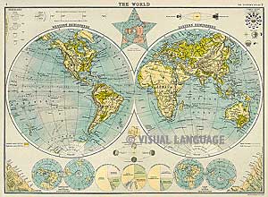
23 Century Atlas, 1897
24 Citizen’s Atlas, 1898 |
|
|
|
|
|
|
| Antique Maps
Homepage
|
Antique Maps of the World: 1520-1680
|
Antique Maps of the World: 1680-1898
|
Antique Celestial Charts and Illustrations
|
Extraordinary Cartographic Motifs
|
Antique Maps of the Continents and Regions
|
|

Any comments or problems with this
site? Please
let us know
- thank you!
Digital Wisdom Inc., Box 11, Tappahannock VA 22560-0011, USA
© Digital Wisdom, Inc.
Tel: 800-800-8560 ~ 804-443-9000
|


